Welcome to Saba
SABA’S HISTORY
History has it that Christopher Columbus saw Saba on November 13, 1493, but did not land there. The island takes its name from the day when Christopher Columbus saw Saba, a Saturday, sabado in Portuguese.
It was in 1632 that English shipwrecked people said, after being rescued, that the island was uninhabited, but that they had discovered traces proving that there had been a presence of Native Americans.
In 1640, the Dutch West India Company installed Dutch peasants from St Eustache. At that time, production was linked to the cultivation of sugar cane in order to produce sugar and rum.
After various attempts at possession, it was the English, with the agreements of Amiens, who occupied the island in 1795. Change of administration during the Second World War with the arrival of an American and British military expeditionary force.
Saba will be returned to the Netherlands in September 1945. Following the dissolution of the State of the Netherlands Antilles in 2010, Saba became a municipality with special status in the Netherlands.
SABA’S GEOGRAPHY
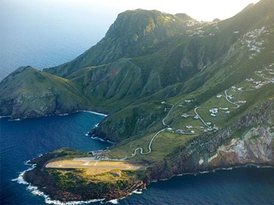
Saba is an island in the north of the Lesser Antilles, southwest of Saint Martin and east of Puerto Rico, in the Caribbean. It is very mountainous and volcanic, covered with tropical forests.
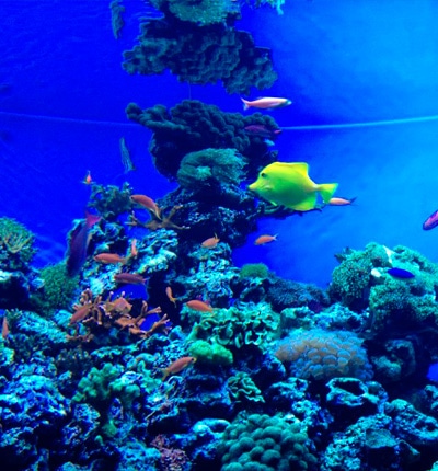
Mount Scenery is the highest point on the island, at 877 meters. The island is made up of cliffs and rocks. The wet vegetation is made up of tropical trees and ferns. Saba is nicknamed the Immaculate Queen (The Unspoiled Queen) and has a marine park that circles the island with beautiful coral reefs.
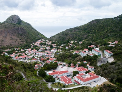
Capital: The Bottom
SABA’S ECONOMY
In the 17th and 18th centuries, the inhabitants lived on the culture of sugar cane and fishing. In order to survive, the men had to work outside the island, becoming sailors or fishermen, which kept them away for long periods from Saba and therefore from their families.
This is how women developed the local economy by making shoes, socks, belts, gloves and straw hats. At the end of the 19th century, lace making became the main resource on the island, thanks to Mary Gertrude Hassell Johnson.
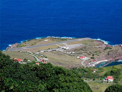
It was with the opening of an airport, in 1963, connecting Saba to Saint Martin, and a pier hosting sailboats and diving boats, in 1972, that the island was able to start developing its economic activity linked to tourism.
An important asset of Saba, its medical university. Created for over 25 years, it has acquired a solid reputation by training a large number of doctors with a success rate of 99%. This university is recognized worldwide.
PLACES TO VISIT IN THE US VIRGIN ISLANDS
The Dutch Saba Museum in Windwardside
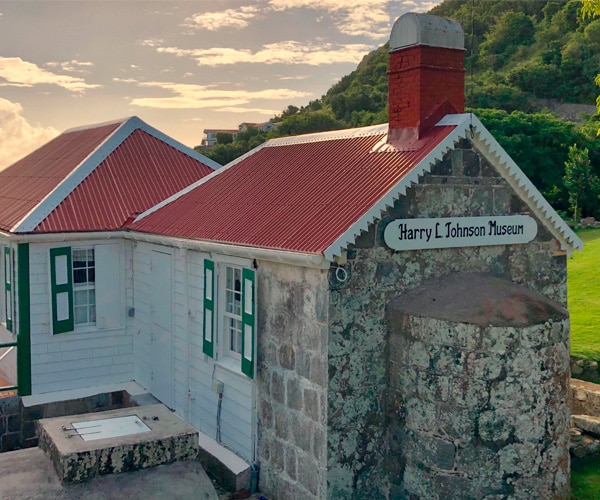
Harry L. Johnson Museum in Windwardside
Church of Christ, the oldest on the island, built in 1777 at The Bottom.
In the 20th century, an 800-step staircase was built, carved out of the mountain. This connects the port of Ladder Bay to The Bottom.
USEFUL INFORMATION
Status: Dutch municipality with special status
Airport: SAB Juancho E. Yrausquin
Climate: Tropical, warm but temperate with the trade winds
Traffic: Driving on the right on the only road serving the whole island
Currency: Netherlands Antillean Guilder (ANG)
Electricity: 110: 220 V – 60 Hz
Fees and taxes: Government tax 5%. Service charges between 10 and 15%
International telephone call code: + 599 – 5
Language: Dutch and English
TOURISM OFFICE WEBSITE